IN PICTURES: Storm Pia batters Denmark
Storm Pia made landfall in Denmark on Thursday afternoon, and strong winds and flooding caused substantial damage across Denmark.
Residents in the southern part of the Kattegat area and the adjacent fjords have been told to remain on high alert as storm Pia begins to subside on Friday afternoon.
UPDATED: How is Storm Pia affecting travel in, to and from Denmark?
Elevated water levels threaten coastal and low-lying regions, with the Danish Meteorological Institute (DMI) predicting water levels of up to 190 centimetres.
Storm Pia made landfall on the west coast of Jutland on Thursday afternoon, and the Danish Meteorological Institute (DMI) recorded wind speeds of 30.3 meters per second in Thorsminde, which is equivalent to a strong storm.
Thyborøn experienced hurricane-force winds of 44 meters per second.
On Friday morning, the insurance company Topdanmark reported 115 claims for storm-related damage. Reports included cases of broken roof tiles, shattered windows, and overturned fences.
In pictures - the impact of Storm Pia:
The Viking Ship Museum in Roskilde, west of Copenhagen, experienced strong winds and flooding in the wake of Storm Pia. Below you can see the staff battle to secure furniture.
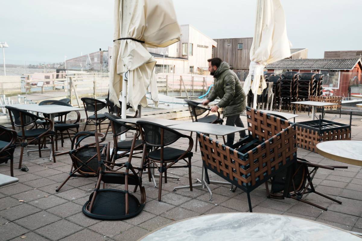
Photo by: Thomas Traasdahl / Ritzau Scanpix
Hornbæk, on the north coast of the Danish island of Sjælland, was impacted by flooding as Storm Pia swept across Denmark on Thursday, bringing hurricane-force gusts.
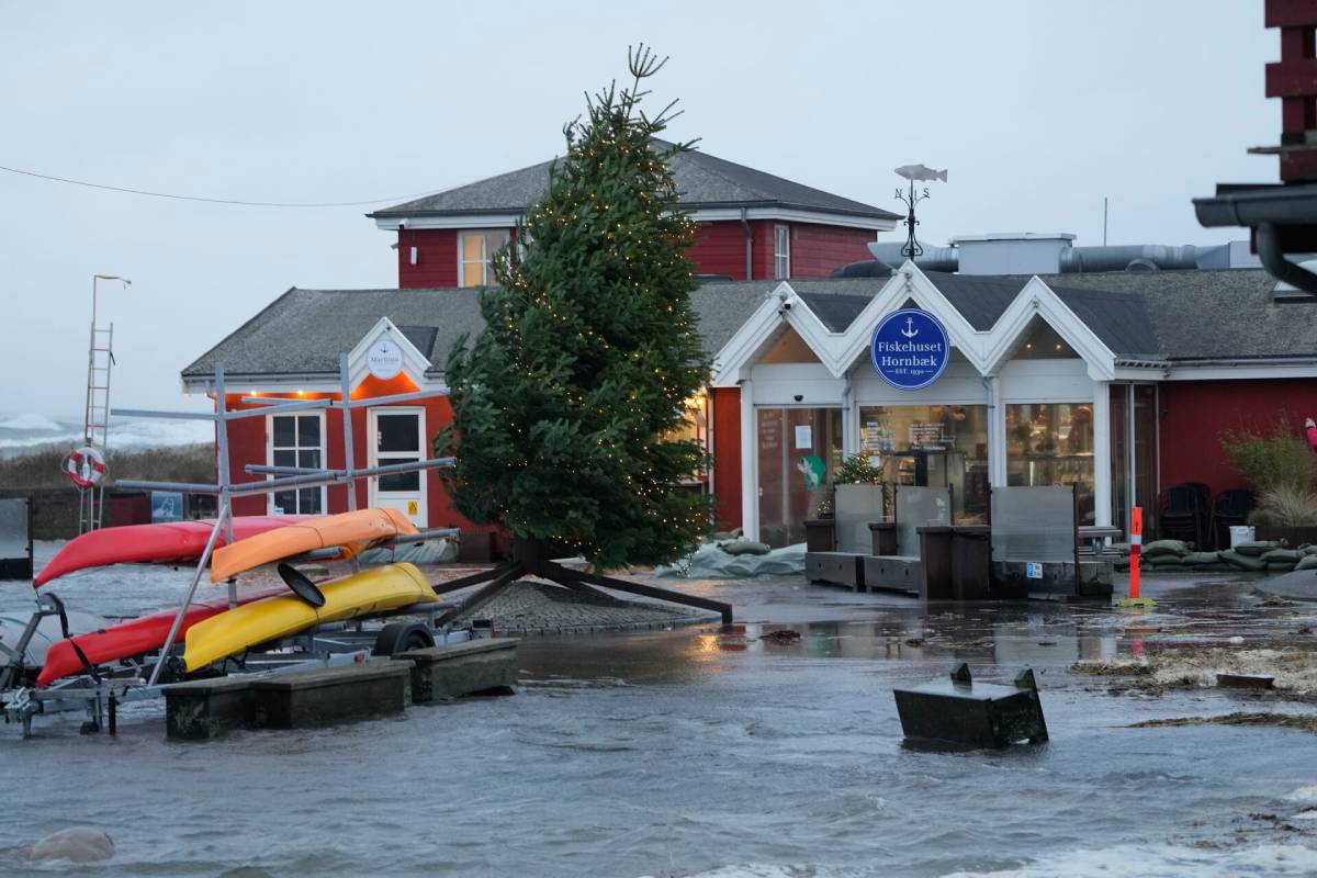
Photo by: Keld Navntoft / Ritzau Scanpix
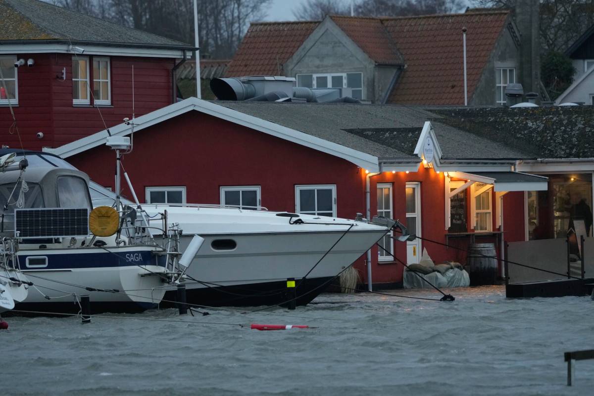
Photo by: Keld Navntoft / Ritzau Scanpix
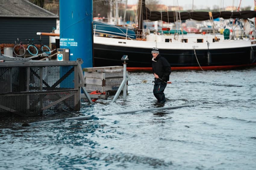
On Friday, Aarhus also bore the signs of the storm's impact. Emergency workers had set up flood defences to protect the city on Thursday. Below you can see the city's floodgates in operation.
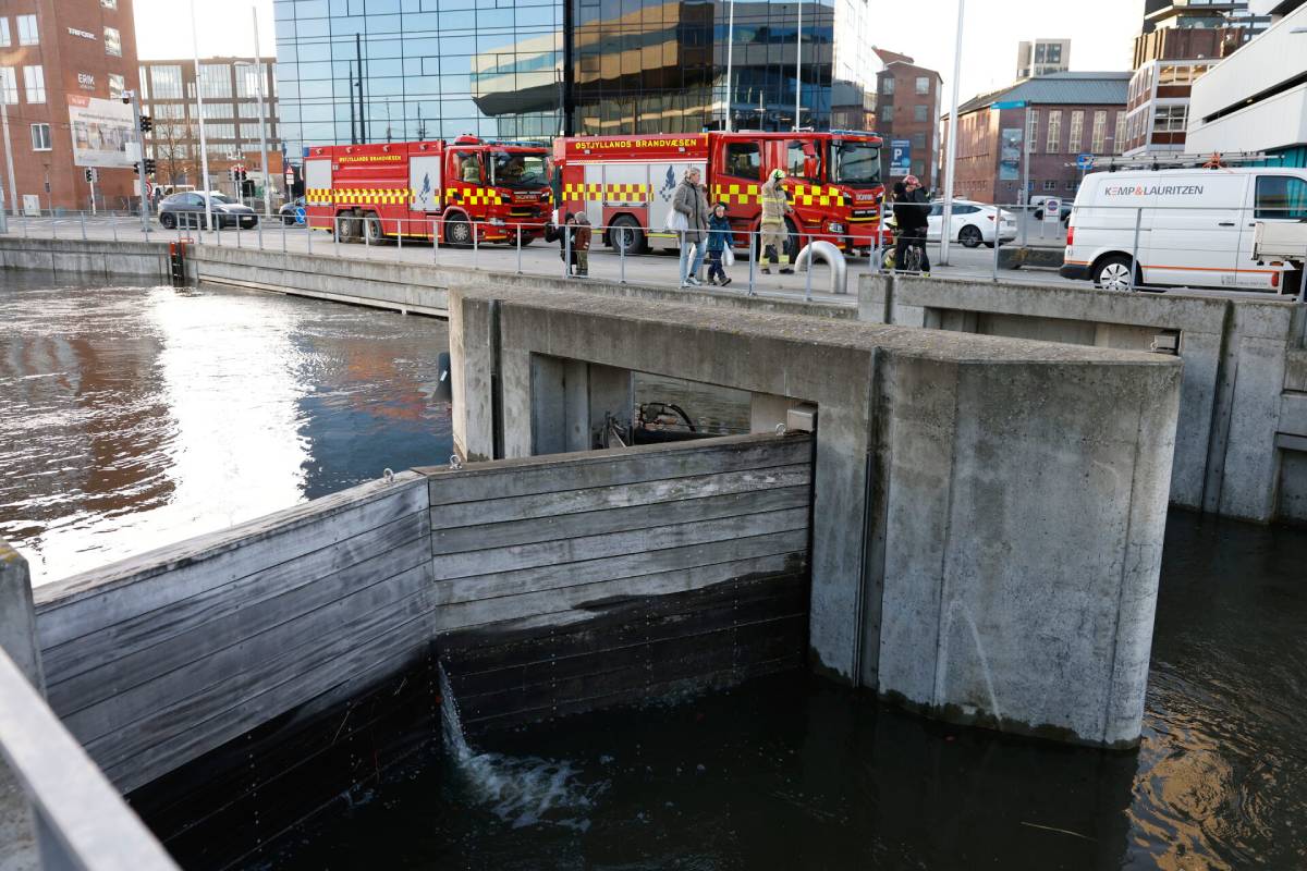
Photo by: Mikkel Berg Pedersen / Ritzau Scanpix
The storm's impact was most keenly felt on Thursday when it peaked in intensity.
In Fredrikssund, the municipality deployed flood defences, and stormy seas battered the coast of Zealand on Thursday afternoon.
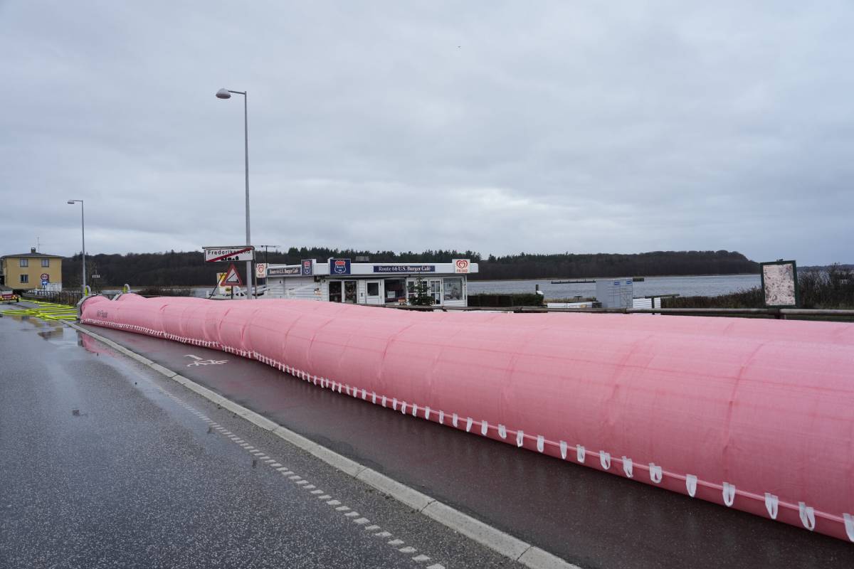
Photo by: Keld Navntoft / Ritzau - Scanpix
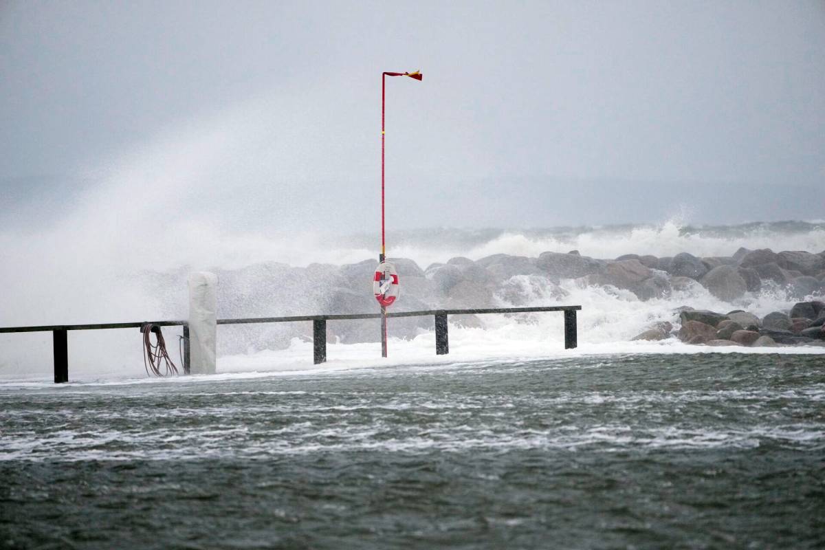
Photo by: Keld Navntoft / Ritzau Scanpix
Comments
See Also
Residents in the southern part of the Kattegat area and the adjacent fjords have been told to remain on high alert as storm Pia begins to subside on Friday afternoon.
UPDATED: How is Storm Pia affecting travel in, to and from Denmark?
Elevated water levels threaten coastal and low-lying regions, with the Danish Meteorological Institute (DMI) predicting water levels of up to 190 centimetres.
Storm Pia made landfall on the west coast of Jutland on Thursday afternoon, and the Danish Meteorological Institute (DMI) recorded wind speeds of 30.3 meters per second in Thorsminde, which is equivalent to a strong storm.
Thyborøn experienced hurricane-force winds of 44 meters per second.
On Friday morning, the insurance company Topdanmark reported 115 claims for storm-related damage. Reports included cases of broken roof tiles, shattered windows, and overturned fences.
In pictures - the impact of Storm Pia:
The Viking Ship Museum in Roskilde, west of Copenhagen, experienced strong winds and flooding in the wake of Storm Pia. Below you can see the staff battle to secure furniture.
Hornbæk, on the north coast of the Danish island of Sjælland, was impacted by flooding as Storm Pia swept across Denmark on Thursday, bringing hurricane-force gusts.
On Friday, Aarhus also bore the signs of the storm's impact. Emergency workers had set up flood defences to protect the city on Thursday. Below you can see the city's floodgates in operation.
The storm's impact was most keenly felt on Thursday when it peaked in intensity.
In Fredrikssund, the municipality deployed flood defences, and stormy seas battered the coast of Zealand on Thursday afternoon.
Join the conversation in our comments section below. Share your own views and experience and if you have a question or suggestion for our journalists then email us at [email protected].
Please keep comments civil, constructive and on topic – and make sure to read our terms of use before getting involved.
Please log in here to leave a comment.