What happened to Denmark’s heatwave?
Much of Europe is being baked in a record heatwave, but in Denmark the month of July has so far mainly been marked by rain and lower temperatures. So should we breathe a sigh of relief – or brace for what's still to come?
Almost exactly one year ago, on July 20th 2022, the temperature record for the month of July was set in Denmark, with a sweltering 35.9 degrees measured at Abed on the island of Lolland.
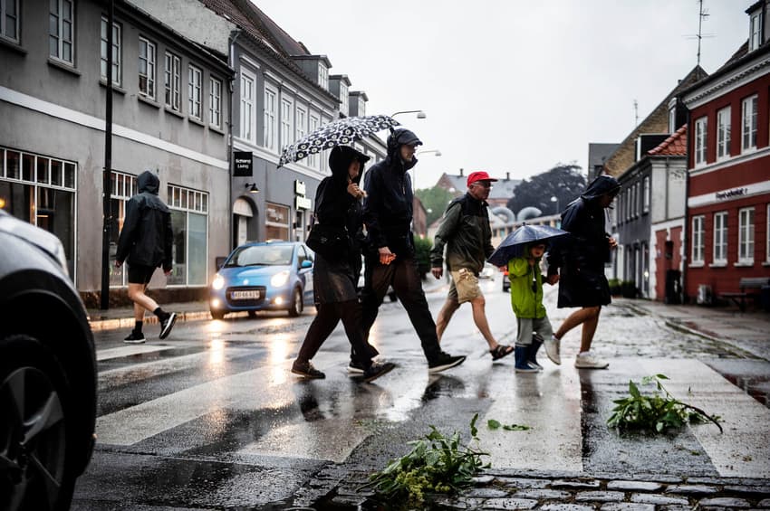
The story in July 2023 has been a different one, with mixed summer weather involving plenty of wind and showers, with temperatures a lot more moderate, ranging between 17 and 22 degrees this week.
Ustadigt sommervejr med blæst 💨 og byger ⛈️ med temp. mellem 17 og 22 grader.
Fra i eftermiddag aftager bygeaktiviteten gradvist vestfra.
Følg bygerne 👉https://t.co/WPtHsJdrql pic.twitter.com/4UloJMpkP1
— DMI (@dmidk) July 17, 2023
July has in fact been wetter and colder than the average for Denmark, because a jet stream is currently blocking the European heatwave from reaching Scandinavia.
The jet stream, which is formed when cool air masses meet warm air masses, is pushing the low-pressure weather towards Scandinavia while at the same time pushing the high-pressure band towards southern Europe.
On this occasion the jet stream is protecting Denmark and the rest of Scandinavia from a serious heatwave and providing some much-needed relief from the drought in June.
But that doesn’t mean that dry weather – and potential drought risks, like those seen in June – can’t return later in the summer.
READ ALSO: Denmark ends last open fire ban as drought subsides
A high-pressure front over north and northeastern Europe is likely to be a “major player” in late summer weather stretching into September, national meteorological agency DMI said in a medium-term forecast published on its website on Wednesday.
While giving temperatures “around or a little over” the normal for September, the front will also result in some rainy weather in both August and September according to DMI.
Overall, however, the weather in the late summer is likely to be a mixed bag like it has been in July, with some potential for above-average temperature, especially in September.
“When the high pressure is far away, or if it shifts to the southeast at some point, it will make room for low pressure from the Atlantic to pass Denmark from the west and southwest. The low-pressure fronts will bring cloudy days with rain, showers and refreshing winds,” DMI writes.
“Occasionally the high pressure looks likely to be closer, and when that happens, warm air will move up over us from the east and south-east, and then we could have some late summer days with light winds, dry and sunny weather,” it continues.
“The forecast is still uncertain, and it is possible that the high pressure will either generally be closer – with more and longer periods of heat and sun as a result – or that it will be located further to the east, opening the way for cold air with rain to flow down across the country from the north,” DMI says.
Comments
See Also
Almost exactly one year ago, on July 20th 2022, the temperature record for the month of July was set in Denmark, with a sweltering 35.9 degrees measured at Abed on the island of Lolland.
The story in July 2023 has been a different one, with mixed summer weather involving plenty of wind and showers, with temperatures a lot more moderate, ranging between 17 and 22 degrees this week.
Ustadigt sommervejr med blæst 💨 og byger ⛈️ med temp. mellem 17 og 22 grader.
— DMI (@dmidk) July 17, 2023
Fra i eftermiddag aftager bygeaktiviteten gradvist vestfra.
Følg bygerne 👉https://t.co/WPtHsJdrql pic.twitter.com/4UloJMpkP1
July has in fact been wetter and colder than the average for Denmark, because a jet stream is currently blocking the European heatwave from reaching Scandinavia.
The jet stream, which is formed when cool air masses meet warm air masses, is pushing the low-pressure weather towards Scandinavia while at the same time pushing the high-pressure band towards southern Europe.
On this occasion the jet stream is protecting Denmark and the rest of Scandinavia from a serious heatwave and providing some much-needed relief from the drought in June.
But that doesn’t mean that dry weather – and potential drought risks, like those seen in June – can’t return later in the summer.
READ ALSO: Denmark ends last open fire ban as drought subsides
A high-pressure front over north and northeastern Europe is likely to be a “major player” in late summer weather stretching into September, national meteorological agency DMI said in a medium-term forecast published on its website on Wednesday.
While giving temperatures “around or a little over” the normal for September, the front will also result in some rainy weather in both August and September according to DMI.
Overall, however, the weather in the late summer is likely to be a mixed bag like it has been in July, with some potential for above-average temperature, especially in September.
“When the high pressure is far away, or if it shifts to the southeast at some point, it will make room for low pressure from the Atlantic to pass Denmark from the west and southwest. The low-pressure fronts will bring cloudy days with rain, showers and refreshing winds,” DMI writes.
“Occasionally the high pressure looks likely to be closer, and when that happens, warm air will move up over us from the east and south-east, and then we could have some late summer days with light winds, dry and sunny weather,” it continues.
“The forecast is still uncertain, and it is possible that the high pressure will either generally be closer – with more and longer periods of heat and sun as a result – or that it will be located further to the east, opening the way for cold air with rain to flow down across the country from the north,” DMI says.
Join the conversation in our comments section below. Share your own views and experience and if you have a question or suggestion for our journalists then email us at [email protected].
Please keep comments civil, constructive and on topic – and make sure to read our terms of use before getting involved.
Please log in here to leave a comment.