What climate science says about this year's cold, snowy winter in the Nordics
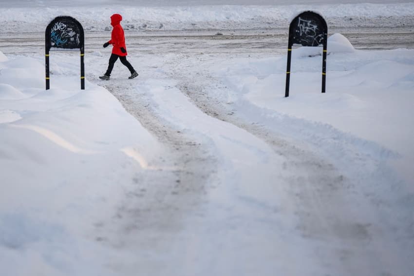
There's been record snowfall and chilly temperatures this month across Sweden, Norway and Denmark -- hardly what you expect from global heating. But according to experts, it's very much in line with what the models predict.
Hald, near Randers in Jutland, this month recorded half a metre of snowfall in just a few days, the heaviest snowfall recorded in Denmark for 13 years.
The two weather stations at Ramnes and Enebakk south of Oslo earlier this week recorded snow depths of 79cm and 64cm respectively, both setting new records for January.
Vittangi, near Kiruna in northern Sweden, earlier in January recorded the country's lowest temperature this century, -44.6C, while between September and November, snow depth records were broken across the north of the country, from Kiruna right down to Uppsala.
Might a warmer climate mean more snow?
Meteorologists and climate scientists told The Local that increased snowfall was entirely compatible with what you might expect from climate science.
"Climate-wise, the prediction would be that in a warmer winter climate there will be more snowfall," said Peter Ditlevsen, a professor at Copenhagen University's Niels Bohr Institute. "This is because warm air -- including when warm means -1C rather than -15C -- contains more precipitable water, which becomes snow."
And as well as there being more precipitation, it's also likely to fall more unevenly, added Matilda Hallestig, a climate educator at the Norwegian Meteorological Institute.
"We will get more short, but very intense events with a lot of precipitation, and then in between them, we will get longer periods of drought, so the snowfall we are seeing fits that expectation," she said.
Thorsten Mauritsen, a professor at Stockholm University, told The Local back in August that as a rule of thumb, for every one percent rise in temperature, seven percent more water evaporates into the atmosphere, all or most of which must fall somewhere.
But he argued this week against that this was not necessarily the case when it comes to snow.
"Snowfall extremes behave a bit differently from summer rain extremes", he said, "in that they don't change much with climate change".
READ ALSO: How global heating could alter Nordic summers
Might a warmer climate bring colder weather to the Nordics?
Hallestig said that some climate models predicted that because the Arctic is warming more rapidly than lower latitudes, cold Arctic air is more likely to be pushed or dragged down over Scandinavia.
"Before, the border between the Arctic air and more southerly air was steadier, but with the climate change, there are theories that it will wobble much more," she said. "So even if we get a warmer climate overall we will get these waves or tongues of really cold Arctic air that will come down further south than they used to."
This is more or less what Mauritsen describes as happening in recent weeks.
"The latest weeks of blistering cold have been associated with a so-called sudden stratospheric warming over the Arctic. This happens irregularly whereby the polar vortex weakens or breaks down, which in turn often causes cold weather over Scandinavia as we get more easterly or northerly winds instead of the dominant westerlies," he said.
When it comes to climate change projections, there are concerns that the present global climate models have a representation of the atmosphere that is too coarse for properly reproducing the jet stream associated with the polar vortex and high-pressure blocking frequency connected with such cold wintertime cold anomalies.
Hallestig's colleague at the Norwegian Meteorological Institute, Rasmus E. Benestad, stressed that there was "no scientific consensus" on whether climate change would lead to more regular break downs in the polar vortex but pointed to a recent report from the Bulletin of the American Meteorological Society that suggested that "changes in the Arctic may also contribute to extreme weather at lower latitudes".
The report conjectured that such a break down in the polar vortex contributed the extreme winter storms seen across the US and Canada in December 2022, when blizzards, high winds, snowfall, and record cold temperatures, caused enormous disruption.
However, Mauritsen said that what had happened this week was probably best put down to, "simply natural variations -- weather basically".
Comments (1)
See Also
Hald, near Randers in Jutland, this month recorded half a metre of snowfall in just a few days, the heaviest snowfall recorded in Denmark for 13 years.
The two weather stations at Ramnes and Enebakk south of Oslo earlier this week recorded snow depths of 79cm and 64cm respectively, both setting new records for January.
Vittangi, near Kiruna in northern Sweden, earlier in January recorded the country's lowest temperature this century, -44.6C, while between September and November, snow depth records were broken across the north of the country, from Kiruna right down to Uppsala.
Might a warmer climate mean more snow?
Meteorologists and climate scientists told The Local that increased snowfall was entirely compatible with what you might expect from climate science.
"Climate-wise, the prediction would be that in a warmer winter climate there will be more snowfall," said Peter Ditlevsen, a professor at Copenhagen University's Niels Bohr Institute. "This is because warm air -- including when warm means -1C rather than -15C -- contains more precipitable water, which becomes snow."
And as well as there being more precipitation, it's also likely to fall more unevenly, added Matilda Hallestig, a climate educator at the Norwegian Meteorological Institute.
"We will get more short, but very intense events with a lot of precipitation, and then in between them, we will get longer periods of drought, so the snowfall we are seeing fits that expectation," she said.
Thorsten Mauritsen, a professor at Stockholm University, told The Local back in August that as a rule of thumb, for every one percent rise in temperature, seven percent more water evaporates into the atmosphere, all or most of which must fall somewhere.
But he argued this week against that this was not necessarily the case when it comes to snow.
"Snowfall extremes behave a bit differently from summer rain extremes", he said, "in that they don't change much with climate change".
READ ALSO: How global heating could alter Nordic summers
Might a warmer climate bring colder weather to the Nordics?
Hallestig said that some climate models predicted that because the Arctic is warming more rapidly than lower latitudes, cold Arctic air is more likely to be pushed or dragged down over Scandinavia.
"Before, the border between the Arctic air and more southerly air was steadier, but with the climate change, there are theories that it will wobble much more," she said. "So even if we get a warmer climate overall we will get these waves or tongues of really cold Arctic air that will come down further south than they used to."
This is more or less what Mauritsen describes as happening in recent weeks.
"The latest weeks of blistering cold have been associated with a so-called sudden stratospheric warming over the Arctic. This happens irregularly whereby the polar vortex weakens or breaks down, which in turn often causes cold weather over Scandinavia as we get more easterly or northerly winds instead of the dominant westerlies," he said.
When it comes to climate change projections, there are concerns that the present global climate models have a representation of the atmosphere that is too coarse for properly reproducing the jet stream associated with the polar vortex and high-pressure blocking frequency connected with such cold wintertime cold anomalies.
Hallestig's colleague at the Norwegian Meteorological Institute, Rasmus E. Benestad, stressed that there was "no scientific consensus" on whether climate change would lead to more regular break downs in the polar vortex but pointed to a recent report from the Bulletin of the American Meteorological Society that suggested that "changes in the Arctic may also contribute to extreme weather at lower latitudes".
The report conjectured that such a break down in the polar vortex contributed the extreme winter storms seen across the US and Canada in December 2022, when blizzards, high winds, snowfall, and record cold temperatures, caused enormous disruption.
However, Mauritsen said that what had happened this week was probably best put down to, "simply natural variations -- weather basically".
Join the conversation in our comments section below. Share your own views and experience and if you have a question or suggestion for our journalists then email us at [email protected].
Please keep comments civil, constructive and on topic – and make sure to read our terms of use before getting involved.
Please log in here to leave a comment.